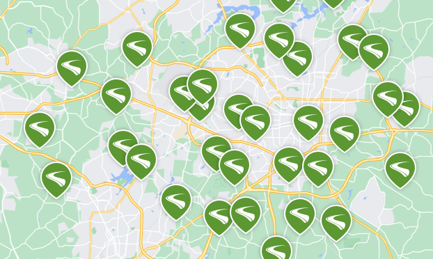
Explore the best rated trails in Toledo, OH, whether you're looking for an easy walking trail or a bike trail like the University/Parks Trail and East-West Connector Trail . With more than 38 trails covering 347 miles you're bound to find a perfect trail for you. Click on any trail below to find trail descriptions, trail maps, photos, and reviews.
If you park at the old rail depot in monroeville off SR 99 you can ride 4.8 miles east to downtown Norwalk. Our favorite restaurant is the freight house.
I rode 2.9 miles on an out-and-back ride on the Mad River Bike Trail in Tiffin, Ohio. This rail trail runs from the Seneca County Fairgrounds to the old Tiffin Train Depot located on the corner of N. Monroe and Brenner Streets. The trail runs along Fair Lane which is located on the perimeter of the Seneca County Fairgrounds. Fair Lane was actually built on the old railbed based on my observation of where the trail continues on the other side of Hopewell Avenue.
Crossing over Hopewell Avenue brings you to the nicest portion of the trail. The next half mile runs between the backyards of the surrounding streets. The pavement here is wide and in very good shape. Once you reach and cross Sandusky Street, the trail conditions change. The trail narrows to the size of a sidewalk as it runs parallel to Brenner Street. When you reach West Market Street, Brenner St. becomes a boulevard and the trail then runs in the median between the two directional halves of the street from West Market to Clay Street. After crossing Clay Street, Brenner is no longer a boulevard but the trail continues paralleling Brenner until both the trail and the street end at the Tiffin Train Depot at N. Monroe Street.
The condition of the trail seems to deteriorate as you travel toward the train depot. It appears that there is just less usage of the trail on the northern end of the trail. The pavement is more worn and crumbling in some spots. I found it unusual that there would be sharrows painted on Brenner Street while the trail was running through the median of its boulevard section. On a positive note, there are rider/pedestrian operated flasher crossing signals as the trail crosses over W. Market and W. Perry Streets.
The Mad River Bike Trail appears to be a nice way to access the Seneca County Fairgrounds for some of Tiffin, Ohio’s residents. However, at present, I view this trail's utility as limited. It is not a trail that I would recommend to people from outside of Seneca County unless the southwestern end of the trail is extended approximately 13 miles to Carey, Ohio.
just walked this trail earlier today some spots on trail was a muddy mess, it's a gravel trail... Other then that not a bad trail.
The trail is mostly really nice with great scenery along the entire thing. West of Norwalk, you will run into few issues, with the dip just to the West of the trailhead having some ruts due to runoff. Going East from Norwalk has some beautiful farmland, but you would be wise to keep an eye down at the trail itself. From ruts and potholes formed to attempts to fill these with sand, along with smelly evidence of horses, there are plenty of things that could quickly wreck your day if you aren't paying close attention. I've tried submitting a review previously, but maybe negative reviews are not authorized? Makes me wonder if any reviews are worth their salt on here honestly.
Not a real good pick. Very rundown, overgrown plants, Graffiti. We went at dusk on a Friday night and the parking lot by the bay had a lot of people and unsafe looking. Would not recommend.
First time on this trail. Serene. Tree canopied sections. Beautiful farmland views. Great stop over the Huron River. Nice depot stop in Monroeville. Wasn’t fond of the ride into Norwalk but it wasn’t horrible. I also wasn’t sure how I was going to like the crushed limestone surface but I really enjoyed the varied surface of the trail. Some of it was fairly smooth rolling. Some required constant pedaling due to a more depth of the stone, which I did not mind because I ride for exercise. Some of the trail was a bit rougher with some actual gravel spots but kept it interesting. Attention is wise anytime someone rides but this trail should be noted the shoulders aren’t always squared. They’re are sections they do slope quite a bit which can out you off the sideif yours not watching.
I live close to Fallen Timbers and pick up both the north and south paths often and I have road the whole south trail a couple times. I ride both a full suspension and no suspension mountain bikes from the early 2000s. Either is adequate for the parts of the trail I’ve road on. I find the trail beautiful. I’d like to make it out to Montpelier but have only made it just past the detour between Delta and Wauseon. The posted detour has you going about 4-5 miles on county roads. This is very dangerous. I would not recommend as the traffic is very fast and if cars come from both directions you have to get off and the off often ends up in a ditch and not easy. I’ve found it better to just continue on the path and avoid the detour. But this places you along the railroad tracks and it’s very difficult to ride. They are active tracks also and trains will come by. Riding on the trail though the detour is possible but rough and the part that goes over the tracks and along them is not marked well. It took some exploring to figure it out. I can’t speak for the trail after wauseon to Montpelier as I haven’t made it that far but the parts I’ve road are a great path for all day riding. You will have to cross streets along the way so you will have starting stopping.
Fremont to Bellevue section. Trail is flat and paved in good condition. Biked to Bellevue to lunch and back for a 25 mile round trip. Not much shade, goes through mostly farmlands. In the 12 miles from Fremont to Bellevue, 21 road crossings! Most of them there wasn't much traffic but you still had to stop, once you got going. In the past biked from Elmore to Fremont, found it to be more scenic.
I tried the trail for the first time today. I started at the parking lot off Barton. As I entered the city, I found it very confusing. Various trails ended up on city streets with no indication of where the trail picked up again. I finally was able to find my way to the long stretch along the river. More markings are needed, especially where the trail branches off, to help guide us on the right direction!
What a relaxing ride! This was my first “big” ride on my Recumbent bike. It was easy to navigate, smooth and well marked. There’s several distance options you can choose from to ride, walk or jog. I would recommend the Slippery Elm for families or just soloists.
Scenery is beautiful but the asphalt is in terrible condition—big bumps, cracks, tree root damage, etc. I ride lots of trails, but I won’t ride this one again unless/until it has a major overhaul. Pls pls fix the trail!!

TrailLink is a free service provided by Rails-to-Trails Conservancy (a non-profit) and we need your support!


Scan the QR code to get TrailLink on your phone